
Mexico to Panama: Overland Transport & Border Crossings - Essential Guide
Navigate Your Journey with Confidence and Style
From Southern Mexico to the Edge of South America
Stretching from southern Mexico to the edge of South America, this corridor is one of the world’s great overland routes.
Travellers move through a chain of eight countries connected by buses, shuttles, ferries, and a series of busy, character‑filled border posts.
This guide explains how modern travellers navigate that entire spine — the long‑distance routes, the regional connections, the practical realities at each crossing, and the transport options that link Mexico, Belize, Guatemala, Honduras, El Salvador, Nicaragua, Costa Rica, and Panama into one continuous journey.
Whether you’re travelling the whole corridor or dipping into a single section, this page brings the region’s overland network into one clear, accessible place.
Xocomil Tours - shared shuttle service: Panajachel, Guatemala to San Cristobal, Mexico
Tica Bus - Tapachula, Mexico to all of Central America
Mexicana - fly Cd. de México (NLU) to Palenque (PQM)

Caribe Fun Tours - Puerto Viejo – Caribbean Coast, Costa Rica
Marvelus - book shared minivans in Central Ameriica
ADO Autobuses de Oriente - south and east Mexico, including the Yucatan Peninsula and Chiapas
Primera Plus Mexico - central and western Mexico

Nica Expreso - bus travel within Nicaragua
Iskra Travel - airport shuttles from Managua and Liberia International Airports to San Juan Del Sur, Nicaragua

Copa Air (Panama)

Quetzal Shuttle, Guatemala

A La Carta Tours, Antigua & Lake Atitlan, Guatemala

Adrenalina Tours, Guatemala
Antigua Tours / Shuttles - Guatemala

Taxi Flores Tikal
Atitrans, Antigua Guatemala and Panajachel
Guatemala Transportation

NEWay Tours, Guatemala
Airport transfers from La Aurora International Airport in Guatemala
San Ignacio Shuttle Service, Belize City to Tikal
Trans-Land Shuttle Service, Guatemala
How Travellers Move Through the Corridor
The Mexico–Panama corridor is not experienced as eight separate countries but as a single, continuous movement south. Travellers follow a natural flow shaped by geography, transport networks, and the shared stories of those who came before them. The journey unfolds in segments: long bus rides between major cities, shorter shuttle hops to reach borders, and local links that stitch together the last few kilometres.
Border days have their own rhythm: early starts, paperwork windows, queues, and the relief of stepping into a new country with a fresh set of onward options. The corridor works because each country connects cleanly to the next, forming a chain of routes that can be followed in one long sweep or broken into smaller arcs.
The Gringo Trail: The Cultural Spine of the Americas
The Gringo Trail is not a marked path or an official route. It is a cultural phenomenon — a loosely defined overland journey shaped by hostels, guidebooks, word‑of‑mouth, and the gravitational pull of certain towns. It is the shared route that backpackers, language learners, digital nomads, and long‑term wanderers follow through Latin America.
What the Gringo Trail Is
At its core, the Gringo Trail is a social and cultural corridor — the path where travellers meet each other, exchange stories, share transport tips, and move in a kind of slow, collective migration. It is not about ticking off destinations; it is about the continuity of the journey and the community that forms along the way.
Where It Begins
For many, the trail begins in Mexico — Mexico City, Oaxaca, or the Yucatán — though some begin even further north, drifting down from the United States or Canada. Mexico is the northern gateway, the place where the idea of a long overland journey takes shape.
Where It Ends
Traditionally, the trail is said to end in the far south of the continent: Cusco, La Paz, Patagonia, or even Ushuaia. The Mexico–Panama corridor forms the northern half of this odyssey — the section where travellers find their rhythm, learn the systems, and settle into the long arc of movement.
Who Travels the Trail
Backpackers on gap years, remote workers, surfers, climbers, hikers, Spanish learners, and long‑term wanderers. They travel for affordability, freedom, friendships, and the sense of being part of a larger, living journey.
Antigua: The Great Gathering Point
Antigua is where the northern Gringo Trail slows down. Many arrive intending to stay a few days and end up staying weeks or months. Spanish schools, homestays, cobblestones, and volcanoes create a natural environment for slow travel. Antigua is where people reset their pace and often redefine what they want from the rest of their trip.
Moving South:
The Corridor, Country by Country
Mexico: The Northern Gateway
Mexico’s vast bus network funnels travellers toward two southern exits: Chetumal for Belize and Tapachula for Guatemala. The distances are long, the infrastructure strong, and the journey south begins with a sense of scale.
Long‑distance routes
Mexico City → Oaxaca → Chiapas (San Cristóbal / Palenque)
Cancún → Tulum → Chetumal (Belize border)
Chiapas → Tapachula (Guatemala border)
Border crossings
Chetumal → Belize (Santa Elena / Subteniente López)
Tapachula → Guatemala (Ciudad Hidalgo / Tecún Umán)
Belize: Coastal Links and Island Routes
Belize is narrow and simple to traverse. Water taxis connect the cayes; buses and shuttles handle the mainland. The Punta Gorda boat crossing is one of the corridor’s most characterful links.
Main routes
Chetumal → Corozal → Belize City
Belize City → San Ignacio (Guatemala border)
Belize City → Dangriga / Placencia / Punta Gorda
Border crossings
San Ignacio → Melchor de Mencos (Guatemala)
Punta Gorda → Puerto Barrios (Guatemala) via boat
Guatemala: The Shuttle Grid and Highland Crossings
Guatemala is where the corridor becomes more intimate. Shuttles link Antigua, Lake Atitlán, Flores, and the borders. The highlands create a rhythm of winding roads, mountain towns, and cultural depth. El Florido is the main southbound crossing.
Key flows
Flores → Rio Dulce → Livingston / Puerto Barrios
Flores → Guatemala City / Antigua
Antigua → Lake Atitlán → Quetzaltenango
Antigua → Copán (Honduras)
Border crossings
Melchor de Mencos → Belize
El Florido → Copán Ruinas (Honduras)
Tecún Umán → Mexico
Honduras: The Bridge Between Regions
Honduras connects the northern and southern halves of the corridor. Many travellers pass through quickly, using it as a bridge.
Main corridors
Copán Ruinas → San Pedro Sula → La Ceiba / Utila ferries
San Pedro Sula → Tegucigalpa → El Salvador / Nicaragua
Border crossings
El Florido → Guatemala
El Amatillo → El Salvador
Guasaule → Nicaragua
El Salvador: The Compact Pacific Arc
El Salvador is fast to cross and rich in Pacific coastline. The surf towns and the capital form a short but memorable section of the corridor.
Main routes
Santa Ana → San Salvador → El Amatillo (Honduras)
San Salvador → La Libertad coast
San Salvador → El Tunco / El Zonte
Border crossings
La Hachadura → Guatemala
El Amatillo → Honduras
El Poy → Honduras
Nicaragua: The North–South Spine
Nicaragua offers a simple, linear route through León, Managua, Granada, Ometepe, and Rivas. Peñas Blancas is one of the busiest crossings on the trail.
Main route Honduras border (Guasaule) → León → Managua → Granada → Rivas → Costa Rica border
Border crossings
Guasaule → Honduras
Peñas Blancas → Costa Rica
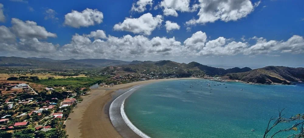
Side routes include San Juan del Sur and Ometepe.
Costa Rica: The Hub‑and‑Spoke System
San José anchors the country’s transport system, with routes radiating toward the Caribbean, the Pacific, and the southern border with Panama.
Main routes
San José → La Fortuna / Monteverde
San José → Manuel Antonio / Uvita
San José → Puerto Viejo (Panama border)
Border crossings
Peñas Blancas → Nicaragua
Sixaola / Guabito → Panama (Caribbean)
Paso Canoas → Panama (Pacific)
Travellers choose based on whether they’re heading to Bocas del Toro or David/Panama City.
Panama: The Final Stretch to the Darién Edge
Panama’s modern highways carry travellers from Bocas del Toro and David to Panama City. Beyond the capital, the road continues to Yaviza, where the Pan‑American Highway stops at the edge of the Darién Gap.
Main routes
Bocas del Toro → David → Santiago → Panama City
Paso Canoas → David → Panama City
Border crossings
Sixaola / Guabito → Costa Rica
Paso Canoas → Costa Rica
How Travellers Actually Move
Most travellers don’t move country by country. They move in arcs:
Mexico → Belize → Guatemala (Caribbean arc)
Guatemala → Honduras → El Salvador (highland + Pacific arc)
El Salvador → Nicaragua → Costa Rica (surf + volcano arc)
Costa Rica → Panama (Caribbean or Pacific arc)
Shuttles dominate border days. Buses dominate long hauls. And Antigua dominates the heart.
Beyond Panama: Continuing into South America
The Darién Gap stops vehicles, not travellers. The corridor continues south by air and sea.
Onward options
Flying from Panama City to Bogotá, Medellín, or Cartagena
Sailing from Panama to Colombia via the San Blas Islands
Taking cargo boats along the Caribbean coast
The South American flow Once in Colombia, the trail expands again — Cartagena, Medellín, Bogotá, the coffee region — before continuing into Ecuador, , Bolivia, Chile, and Argentina.
The Mexico–Panama corridor becomes the northern chapter of a much larger continental journey.
At the Edge of the Darién, Something Shifts
By the time the road reaches Panama City and the highway dissolves into the green wall of the Darién, the traveller has already crossed an entire region in motion. The corridor has taught its own lessons: how to read a bus terminal, how to navigate a border morning, how to fall into step with the slow migration of others heading the same way.
The Gringo Trail threads through it all — the hostels, the shared shuttles, the friendships formed over volcano sunrises and long overnight rides. What begins as a route becomes a community, a moving constellation of people who drift apart and rejoin each other across countries.
South America waits just beyond the gap, but the transformation has already happened. The Mexico–Panama corridor is not just the northern half of a continental journey; it is where travellers learn how to travel.
Popular Destinations and Transport - Mexico to Panama: Featured Plus
-
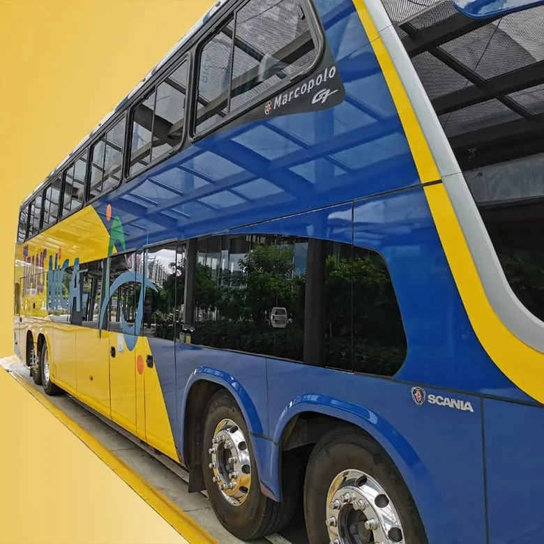
![Viajes Aury]()
buses from San Cristóbal to Tapachula
-
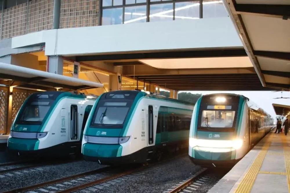
![tren maya - mexico]()
Palenque to Cancún rail journey
-
![Trans Nica - Managua to San Jose, Costa Rica]()
Managua, Nicaragua to San Jose, Costa Rica
-
![Antigua Guatemala copyright Pixabay]()
Antigua
-
![Shuttle Guatemala shuttleguatemala.travel]()
Panajachel, Lago Atitlan
-
![Antigua]()
Antigua, Sacatepéquez
-
![Tikal Go, Flores, Guatemala]()
Flores to Tikal
-
![Coban Travels Guatemala]()
ofrecemos shuttles, tours y transporte privado
-
![Ronney Shuttle]()
Ronney Shuttle - from Honduras to Nicaragua


How Modern Explorers Move, Connect, and Discover
From the deserts of northern Mexico to the rainforests of Panama, travellers increasingly experience Mexico and Central America as a single, fluid journey.
While Mexico is geographically part of North America, from a traveller’s perspective it often marks the beginning of a long, southbound adventure through Spanish-speaking Latin America — moving country by country, overland where possible, guided more by curiosity than borders.
This vast corridor offers ancient civilisations, dramatic landscapes, surf towns, colonial cities, and deeply local cultures.
But who are these travellers, how do they move, how do they connect, and what defines the modern experience of travelling through this region?
How Travellers Move Around
Travel through Mexico and Central America is typically flexible, budget-conscious, and overland-focused. Common transport options include:
Buses and shuttles:
Private shuttle services are a backbone of traveller movement, especially between popular routes such as Cancún–Tulum, Antigua–Lake Atitlán, León–San Juan del Sur, and Panama City–Bocas del Toro. Local buses — often referred to as “chicken buses” in Central America — remain the cheapest and most immersive option.
Shared rides and car rentals:
Ride-sharing apps like Uber are widely used in Mexican cities and some Central American capitals.
Car rentals are common in Mexico, Costa Rica, and Panama, where road infrastructure is more developed.
Air travel:
Budget airlines such as Volaris, Viva Aerobus, Wingo, and Avianca are used for long-distance jumps — particularly when time, safety, or terrain make overland travel impractical.
Many travellers move south in stages: Mexico → Guatemala → Nicaragua → Costa Rica → Panama, adjusting plans as they go.
Border crossings are part of the adventure, often dictating pace and direction.
Networking and Social Media
Modern travellers are deeply networked, relying on digital platforms before and during their journeys:
Facebook groups:
Groups like “Backpacking Mexico & Central America,” “Backpacking Guatemala,” or “Digital Nomads Mexico” function as real-time noticeboards for routes, border updates, safety advice, and meetups.
TripAdvisor and Hostelworld:
Used heavily for accommodation reviews, tours, and transport recommendations.
Instagram and TikTok:
Inspiration engines for destinations, surf spots, ruins, cenotes, jungle stays, and lesser-known towns.
Reddit:
Subreddits such as r/backpacking and r/solotravel provide candid, experience-based advice.
WhatsApp and Telegram:
Crucial for organising shared shuttles, local transport, accommodation groups, and traveller meetups.
While planning often starts online, many connections are made organically in hostels, co-working spaces, cafés, language schools, and on shared transport.
Devices on the Road
Travellers tend to pack light but rely heavily on technology:
Smartphones for navigation, translation, bookings, and communication
Lightweight laptops or tablets for digital nomads and remote workers
Cameras or drones for content creators
Power banks and local SIM cards or eSIMs for constant connectivity
Connectivity across Mexico and much of Central America is generally reliable, even in smaller towns.
Researching Trips
Travel research is now continuous and adaptive:
Before departure:
Guidebooks, blogs, YouTube travel channels, Reddit threads, and social media.
On the road:
Google Maps, Google Reviews, Hostelworld, Facebook groups, and word-of-mouth from fellow travellers and locals.
Plans often change mid-journey — a conversation in a hostel kitchen can redirect an entire route.
Popular Countries and Destinations
Some countries consistently attract more travellers due to infrastructure, safety perceptions, and variety:
Mexico:
A major entry point offering beaches, ruins, cities, food culture, and strong transport networks. Many travellers spend months here before heading south.
Guatemala:
Known for Antigua, Lake Atitlán, Mayan ruins, and cultural depth.
Costa Rica:
Eco-tourism, surfing, wildlife, and well-developed traveller infrastructure.
Panama:
Modern urban life, the Panama Canal, and island destinations like Bocas del Toro.
Belize:
Reef diving, English-language ease, and a slower pace.
Nicaragua:
Volcanoes, colonial cities, and surf towns, though political concerns influence traveller numbers.
Countries like Honduras and El Salvador are less visited but increasingly explored by more experienced travellers seeking less-trodden paths.
Where Travellers Come From
The region attracts a diverse mix:
North Americans: Especially from the U.S. and Canada
Europeans: Particularly from Germany, the UK, France, Spain, and the Netherlands
Australians and New Zealanders: Often on extended, multi-country trips
Travellers vs. Tourists
The distinction is often philosophical rather than practical:
Travellers:
Independent, flexible, longer-term, budget-aware, and experience-driven.
Tourists:
More structured itineraries, resorts, guided tours, and fixed schedules.
While backpackers aged 20–35 dominate hostel culture, older travellers increasingly pursue slow travel, eco-tourism, and cultural immersion.
Historical Context
Independent travel through Mexico and Central America expanded significantly in the 1960s and 1970s along the hippie and backpacker trail. Before the internet, travellers relied on:
Printed guidebooks and maps
Hostel noticeboards
Word-of-mouth and handwritten notes
Today’s digital tools have accelerated information sharing, but the core ethos remains unchanged.
The Darién Gap: Where the Road Ends
One critical break in the overland journey occurs between Panama and Colombia: the Darién Gap.
This dense, lawless stretch of jungle has no roads and is widely regarded as one of the most dangerous regions in the world.
Despite occasional stories of attempted crossings, overland travel through the Darién Gap is strongly discouraged, particularly for foreign travellers.
For a “gringo” attempting a land crossing, the risks are extreme — including armed groups, criminal activity, disease, wildlife hazards, and lack of rescue infrastructure.
Most experienced travellers instead fly or sail from Panama to Colombia, often via boats through the San Blas Islands or flights from Panama City.
The Darién Gap remains a hard stop — both geographically and practically — in the otherwise continuous north–south journey.
Duration and Continuation
Travel timelines vary widely:
Short trips: 2–3 weeks in one or two countries
Extended travel: 3–12 months across multiple countries
Long-haul journeys: Mexico through Central America, then onward into South America
For many, Mexico and Central America form the first half of a much larger Latin American adventure.
Other Considerations
Language: Spanish dominates; English is common in tourist hubs
Budgets: Backpackers travel cheaply; eco and adventure travellers spend more
Cultural engagement: Language schools, volunteering, homestays, and community tourism are popular ways to connect more deeply
In Summary
Travelling through Mexico and Central America is defined by movement, adaptability, and connection.
Modern travellers blend overland exploration with digital tools, using social networks, mobile devices, and shared knowledge to navigate borders, cultures, and experiences.
While infrastructure and safety vary by country, the region remains one of the world’s great multi-country travel corridors — rich in history, diversity, and the enduring spirit of independent exploration.